Magnetic geophysical
surveys by drones

Magnetic Surveys
with UAV


TERREMYS is a UAV geophysical survey company and is characterized by an innovative service for the measurement, processing, and interpretation of magnetic data.

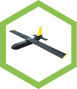
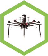
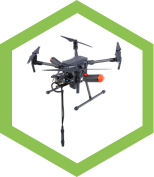
Lightweight UAV Magnetic Surveys

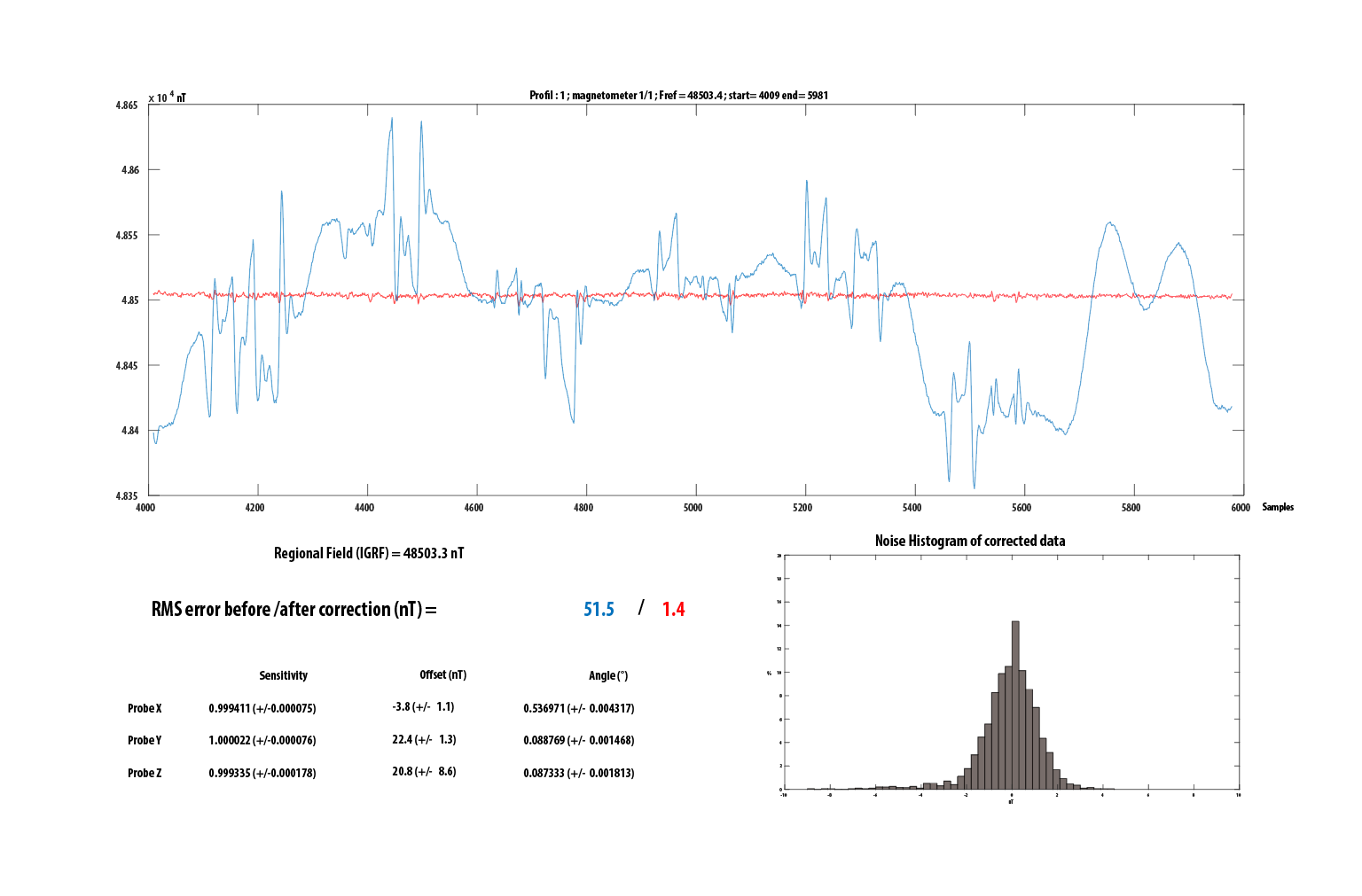
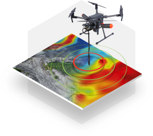
Our L.U.M.S technology allows multi-scale aeromagnetic surveys from 1 to 150 meters using a measuring system weighing less than 500 grams.
This metrological evolution opens new perspectives for geophysical studies applied to the subsoil at depths both shallow and deep while delivering data that meet industry standards and are accurate to the nano-tesla range.

Our innovation
The magnetic compensation of the UAV


Our innovative solution is based on the compensation per figure of merit of the effects of drone magnetization using vector magnetometers. The measurement then becomes possible without a heavy and expensive active compensation system, without having to move or pull the magnetometers, and without having to use gradiometers that are less sensitive to deeper sources.


More information

Flight heights and daily productivity

L.U.M.S.

60 linear km of daily magnetic profiles
30 km / hour

Ease of deployment: lighter implementation
than conventional aeromagnetic methods

Unmanned flights, ensure human safety

Data accuracy :
accurate monitoring of topography

Autogyro

Local measurement scale

L.U.M.S.

200 linear km of daily magnetic profiles
70 km / hour

Ease of deployment: lighter implementation
than conventional aeromagnetic methods

Unmanned flights, ensure human safety

Data accuracy :
accurate monitoring of topography

Aircraft
Helicopter

Regional measurement scale

Ground operator

Hiking surveys: 1 to 4 hectares/day
25 to 100 linear km of daily magnetic profiles

L.U.M.S.

6 to 10 hectares/day
130 to 220 linear km of daily magnetic profiles

Free from the nature and condition
of the soil (mud – crops – obstacles)

Allows multi-scale surveys
at several flight heights

Robotic and automated manual surveys
automated profile tracking

Quad bike

Quad surveys : 8 to 16 hectares/day
200 to 400 linear km of daily magnetic profiles

Local measurement scale

Applications

LOW-ALTITUDE FLIGHTS
1 to 3 meters

- Preventive and programmed archaeology
- Decimetric georeferencing of buried networks
- Pyrotechnic clearance
- Identification of subsoil heterogeneities: search for metallic objects

MID-ALTITUDE FLIGHTS
3 to 150 meters

- General and structural geology (academic research, oil, mining and geothermal reservoirs, etc.)
- Oil and mining exploration
- Risks and active flaws analysis

Advantages

Efficiency

accurate monitoring of the navigation and topography of the mission area

Savings

reduction of costs
and data acquisition times

Flexibility

multi-scale measurements
from 1 m to 150 m AGL

Safety

intelligent and
automated flights

Our partners

If you need any further information,
contact us

Studies

Flight path

Surveys

Data processings

Data delivery